To start off with, I heard you studied meteorology in college. What was that like?
HAWKINS: Yeah, I graduated from Penn State in 1977 with a degree in meteorology. There seems to be a recurring theme that a lot of people who study meteorology and become atmospheric scientists were bit by a weather bug very early in life. That was definitely the case with me.
How so?
HAWKINS: Ever since I was in middle school and 12 years old, I was just obsessed with weather, and the thought that I could go to a college in my own state and learn all the mysterious science that was hiding behind the general description you could get in weather books out of the public library was just very compelling and fascinating.
I knew I wanted to study it. I was fascinated by it. I gave weather forecasts to my homeroom in junior high and high school and watched weather on TV — before the Weather Channel even existed! So it started as a hobby, and getting to college and learning what was really going on behind it was an awakening because not only do you realize there are physical forces behind weather that you can describe with mathematics, but you start to realize that so much depends on weather — so much!
Can you give some examples?
HAWKINS: Transportation, agriculture, commodities trading, emergency preparedness — everything depends on weather. It’s not just about forecasts that save people's lives, but also how are you going to ship your grain across Kansas if there is an ice storm? Or how do you get ships to carry their oil from the Gulf of Mexico to New England ports the fastest way?
And so it just always seemed very relevant and very fascinating to me.
How has the study of weather changed over the years?
HAWKINS: The science of weather really got its legs beginning in World War I era and in the very early 1920s, when a group of Europeans — actually Norwegians — started realizing that you could describe the motions and state of the atmosphere mathematically and that there was a real reason why storms happened that could be traced to a thin atmosphere of gases on a spinning globe. It lent objectivity and predictability, in a mathematical sense, to the science, but this understanding really wasn't greatly advanced until the technologies to observe initial conditions in the first place started happening.
In the 30s, people started flying balloons into the sky with instruments on them so you could measure the temperature and the pressure and the wind with height, because the atmosphere is three dimensional. A heritage company of Lockheed Martin's was one of the first companies to create radiosondes — which are weather balloons with instrument packages on them — for the U.S. military in the 1940s. To this day, a Lockheed Martin company is providing about two thirds of all the radiosondes to the National Weather Service for taking these observations.
Yeah, I read about that. What came next?
HAWKINS: And then radar came along as a derivative of military radar in the 1940s and in the 50s. They started getting installed to be able to observe the development of rain- or snow-producing storms. And they slowly became useful in identifying those particular storms that may be producing tornadoes or hail — still very primitive by today's standards, but it began to work.
In the mid 1950s, it was Lockheed Martin aircraft, notably the C-130s, that were equipped to fly into hurricanes to take measurements so that forecasters could better understand the strength of the storm, whether the storm was dissolving or getting stronger, which way it was moving, and the forces of wind around the storm that could cause it to turn, cause it to increase in strength or decrease. Lockheed Martin aircraft are still instrumented for the U.S. Air Force and for NOAA to fly these reconnaissance missions into hurricanes.
The biggest breakthrough in understanding the atmosphere in terms of just volumes of data that you can apply to that understanding was with the advent of the weather satellite. On April 1, 1960, TIROS-1, also built by an antecedent Lockheed Martin company, became the first weather satellite. Immediately, it showed patterns in clouds over the water where there were no shipborne observers, no radar, and no previous way to get a picture of what was happening in the atmosphere. So the promise of using satellite observations to help observe and forecast the weather became instantly apparent.
You’re leading me right into my next question. How has weather forecasting changed since you first entered the industry?
HAWKINS: Well, when I was finishing college in the 1970s, weather models — mathematical simulations of the atmosphere run forward in time — were pretty weak. The math was there, the physics was there. It was hard to get the computer power big enough to make them speedy enough to be useful, and their accuracy left a lot to be desired. There was a lot of fine-tuning tuning that had to be done and continues to this day.
What satellites effectively did was put in more pieces of the jigsaw puzzle so you had a better idea of what the atmosphere looked like. With weather models, you got a pretty good prediction of general nature of storms as they marched across North America in the late 70s. New data, more refined models and far faster computers allowed that data to be exploited, and models got a lot better.
Forecasting also got a lot better in the 90s, when the National Weather Service underwent a full Modernization program overseen by the National Academies of Science and Congress, where they completely upgraded their radar so that they were now using Doppler radar. It would show you the motion of the storms so you could pick up rotation in storms that could lead to tornadoes — and with Doppler, for the first time ever, identifying tornadoes resulted in getting tornado warnings out often before the tornado touched down. And now the typical tornado warning lead time by a National Weather Service forecast office is on the order of 13 or 14 minutes, which gives people a lot more time to take preparations.
Wow, that’s impressive.
HAWKINS: Meanwhile, a whole new series of satellites was launched. In 1975, the first geostationary satellite for weather observations was launched — the Geostationary Operational Environmental Satellite, GOES. And it just stared down at space from a fixed point over the Americas, and you could watch the weather change underneath you.
What GOES did was really improve hurricane forecasting, because now, every hour or every half hour, you'd have another view over the Atlantic Ocean, and you could see these storms develop over the course of hours and days and draw a bead on them before they hit the coast. Up until then, exactly where the storm was going to go and exactly how strong it was was subject of interpretation that often left a lot of communities blindsided.

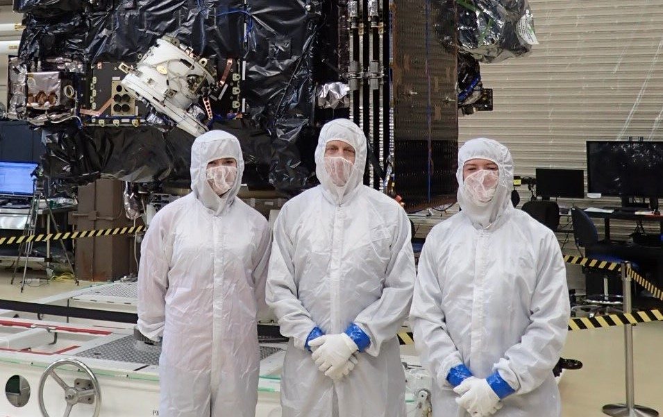
Photo: Jamie stands in front of the GOES-S satellite flanked by two Colorado State fellowship award recipients.
Which emerging technologies do you think will make the biggest impact on the future of weather forecasting?
HAWKINS: So you talk about technologies that have made a difference, seriously, the GOES satellites have absolutely made a difference, and the most recent incarnation, of course, is the Lockheed Martin GOES-R series satellites: R, S, T and U. And even though the first two have only been operating for a couple of years now, people are starting to see the atmosphere, forest fires, ice, etc., in ways that they hadn't before, and the scientists are just scratching the surface on exploiting the utility of the data from those new satellites.
Other important advances over the past decade or so have been in improved weather models. Essentially, that is improving the simulation of the atmosphere at a given point in time and then using the physics to sort of turn the crank of time to 24, 48, 72 hours — even a week or more into the future. Weather models are getting so good, but they're going to get even better because there are efforts afoot in the scientific community between the academicians and people in government to really improve these models. High-speed computing and being able to divest some of the computing resources into the cloud is also making a difference, because now the community of scientists will be able to put advances into weather models and test them and see which particular changes to the models are going to make the forecasts better as time goes on.
For example, at Penn State University's meteorology department — just a coincidence, even though I went there — they took data from the primary infrared imaging system that's on GOES-R, and they gathered that data over a broad swath of the Atlantic and the Gulf of Mexico, and they went and looked at Hurricane Harvey. In 2017, Harvey demolished Eastern Texas with a year's worth of rain in five days. That storm became a Category 4 out of 5 right before it made landfall, but none of the weather models showed that it was going to get that strong — not the U.S. models, not similar models by the Europeans or Canadians, nobody. When Penn State reran all of the past data and added data which indicated how moist the atmosphere was in the middle of the atmosphere, based on measurements from GOES-R, it predicted Harvey would be a Category 4.
Incredible. I know that there's a lot of controversy when it comes to public understanding of weather. What should people keep in mind when it comes to weather forecasting?
HAWKINS: One: Weather forecasts, by objective statistical measures, are very, very good. And a lot of people, myself included, remember the times that they're wrong and don't even think about it when they're right.
Two: When predicting the motions of storms that impact us the most — ice storms, snowstorms, hurricanes — you're still dealing with an atmosphere that attributes part of its motions to chaos, so there's always going to be some measure of error. So if it snows at your house and the call was for rain, not snow, but 10 miles away, it's snowing, you’ve really got to ask yourself how upset you should be that the forecast was a miss for your house but not for your Uncle Charlie, who lives 10 miles away.
Having said that, one of the big thrusts in both government circles like the National Weather Service and in the professional societies like the American Meteorological Society — which catalyzes these types of discussions about forecast improvements — is the involvement of social scientists into formulating better communication strategies for weather forecasts. What good is a perfect forecast if a community doesn't know how to respond to it or if the community doesn't have its emergency managers prepared for it?
That’s a great point. So what are you most excited about for AMS 2020?
HAWKINS: AMS 2020 is the hundredth-anniversary celebration, capstone event of the centennial year of 2019.
I am excited about renewing professional acquaintances, about having fantastic discussions with our customers like NOAA, NASA and the U.S. Air Force and others about what Lockheed Martin is cooking up.
For example, the GeoCarb instrument — which is going to be the first-ever continuous geostationary monitor of carbon dioxide, methane, carbon monoxide, and vegetation health related to the greenhouse gases.
And advances in space weather — staring at the sun and watching emanations from the sun, whether it's the solar wind or ejections of mass that can impinge on the Earth's system and cause GPS blackouts, injure astronauts, cause communications and power-grid failures across the globe.
We’ll have brilliant scientists and engineers at the meeting who are working with important technologies. They’ll be interacting with some of the nearly 5000 professionals and students in attendance from the various fields related to meteorology. This year, we’ve also provided support to undergraduate and graduate students through scholarships and a fellowship. We’ll participate in a great family K-12 weather related STEM event. I’m looking forward to an energizing, reaffirming week. We are in a terrific business that is helping save lives and build the economy by better understanding Earth.

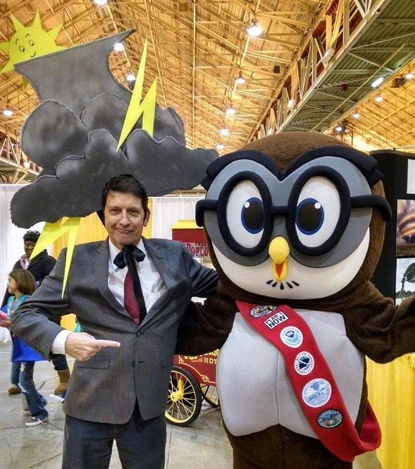
Photo: Jamie strikes a pose with Owlie Skywarn, the mascot of the National Weather Service, during a K-12 STEM outreach event called WeatherFest.


